Ever wondered why so many of London’s biggest attractions seem to line the River Thames?
From Big Ben and the Houses of Parliament to Tower Bridge, St Paul’s Cathedral and Greenwich, many of the city’s most recognisable landmarks share one thing in common: they’re all located on or near the river.
This wasn’t an accident.
Long before London became one of the world’s largest cities, the River Thames was its lifeline. It supplied food, enabled trade, transported people, provided protection, and helped shape London’s growth for nearly 2,000 years.
Even today, the Thames continues to connect many of the places visitors come to see.
The Thames Came Before London’s Roads
Modern visitors often think of London as a city connected by roads, railways and Underground lines.
For much of London’s history, however, the river was the fastest and most reliable way to travel.
Before modern transport networks existed, moving large numbers of people or goods through crowded streets was slow and difficult. The Thames offered a natural highway running straight through the city.
Merchants, sailors, royalty, politicians, workers and visitors all depended on the river.
As London grew, important buildings naturally appeared along its banks.
The Tower of London Was Built to Control the River
When William the Conqueror built the Tower of London in the 11th century, its location was carefully chosen.
The fortress stood beside one of the most important points of entry into the city. Anyone arriving by water would see the Tower and understand who controlled London.
The Thames provided both economic power and military advantage. Controlling the river meant controlling access to the city itself.
Today, visitors can still appreciate this strategic position when viewing the Tower from the water.
Tower Bridge Was Built Because of River Trade
By the late 19th century, London’s port had become one of the busiest in the world.
A new crossing was needed in East London, but there was a problem: ships still needed access to the busy docks upstream.
The solution became Tower Bridge.
Its famous bascules (the movable sections of the bridge) allowed vessels to continue travelling along the Thames while providing an essential crossing point for people and traffic.
More than 130 years later, it remains one of London’s most recognisable landmarks and a reminder of the river’s importance to trade and industry.
St Paul’s Cathedral Was Designed to Be Seen from the River
For centuries, St Paul’s Cathedral dominated London’s skyline.
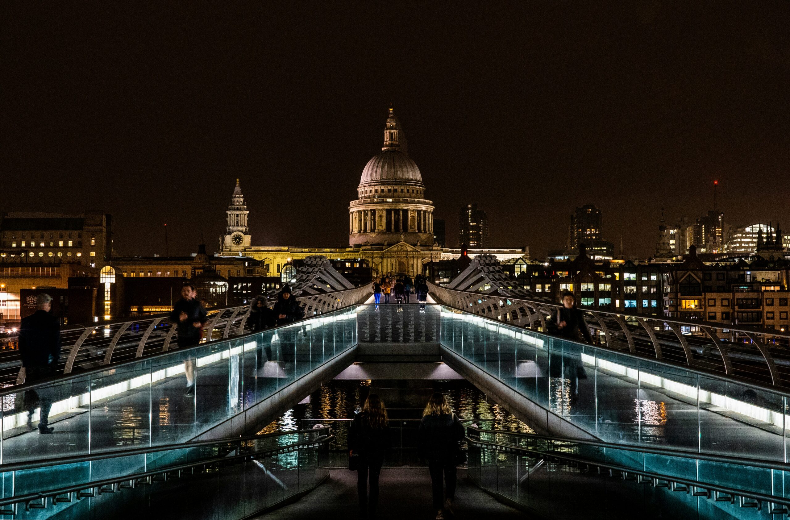
Long before skyscrapers appeared, its magnificent dome could be seen from miles away by people arriving along the Thames.
In many ways, the cathedral was designed to serve as a visual symbol of the city. Merchants, sailors and visitors approaching London by water would immediately recognise its silhouette.
Even today, some of the best views of St Paul’s are still from the river itself, where the dome rises above the surrounding buildings much as it did hundreds of years ago.
Parliament Occupies One of the Most Important Riverfront Sites in Britain
The Palace of Westminster occupies a prime position on the Thames for historical reasons.
For centuries, riverside locations were among the most desirable and practical sites in major cities. The river provided transport, communication and prestige.
The Houses of Parliament grew on the site of a former royal palace, placing Britain’s political centre directly beside the waterway that connected the nation to its capital.
Today, Big Ben and Parliament remain among London’s most photographed riverfront landmarks.
Greenwich Owes Its Importance to the Thames
Few areas demonstrate the relationship between London and the river more clearly than Greenwich.
Located downstream from central London, Greenwich developed as an important maritime centre.
The area became associated with:
- Royal palaces
- Naval power
- Scientific discovery
- Global navigation
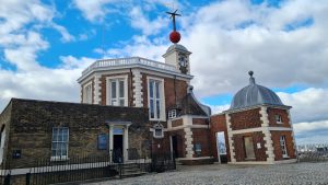
Landmarks such as the Cutty Sark, the Old Royal Naval College and the Royal Observatory all reflect Greenwich’s historic connection to the sea and the Thames.
Without the river, Greenwich would never have become one of Britain’s most significant maritime locations.
The River Created London’s Skyline
When people think of London’s skyline today, they often picture:
- Big Ben
- St Paul’s Cathedral
- Tower Bridge
- The Shard
- Canary Wharf
What’s striking is how many of these landmarks are positioned along the Thames.
The river acts as a natural corridor through the city, creating open views that are difficult to find elsewhere in densely built urban areas.
Many of London’s most iconic photographs exist because the Thames provides the space needed to appreciate these buildings as part of a larger skyline.
The Thames Still Connects London’s Most Famous Attractions
Although London no longer depends on the river for daily transport in the same way it once did, the Thames continues to shape how visitors experience the city.
Many of London’s most famous attractions remain concentrated along its banks, including:
- Westminster
- London Eye
- St Paul’s Cathedral
- Shakespeare’s Globe
- HMS Belfast
- Tower Bridge
- Tower of London
- Greenwich
Following the river today offers a unique way to understand how London developed from a Roman settlement into one of the world’s great capitals.
A Different Way to See London’s History
One of the reasons a journey along the Thames feels so different from travelling through the city streets is that it reveals London’s story in chronological layers.
Roman foundations, medieval fortresses, Victorian engineering, modern skyscrapers and maritime heritage all appear along the same route.
The landmarks themselves may be the headline attractions, but the Thames is the thread that connects them.
Far more than a river running through London, the Thames helped create the city visitors see today.